
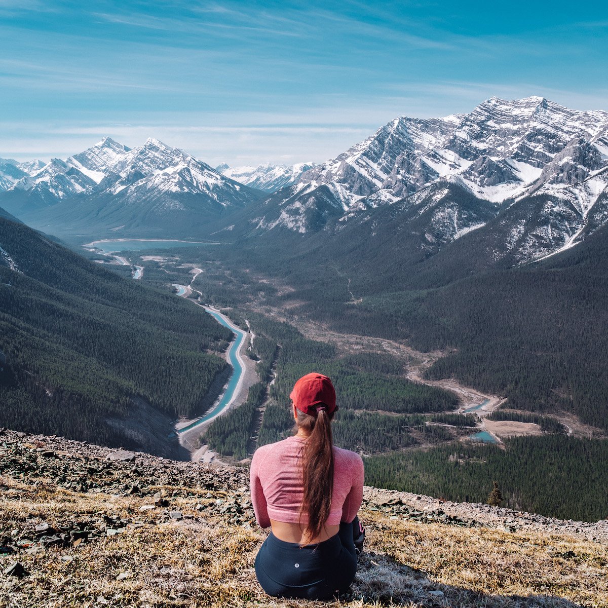
Top 14 Day Hikes Near Calgary
Calgary, although not particularly famous for what’s found in the city, is certainly well known across the globe for what you can find near it. Astoundingly gorgeous lakes, jagged and majestic mountains, hot springs, waterfalls and so much more can be found in the national and provincial parks near Calgary.
I may have a bias, but Alberta is hands down one of the best provinces you can visit in Canada!
Although you can reach many of Alberta’s stunning sceneries by car, I’d be lying to you if I didn’t say that much of its magic and beauty requires a little more than a few steps from the vehicle. To keep our flora and fauna thriving, many of the incredible landscapes are tucked away and the only way to reach them is by foot. Hiking is a must to see these places for yourself!
In an effort to share with all of you my favourite hikes near the Calgary area, I split them up by level of difficulty. This was mostly to break some close ties but also to ensure that I was indeed comparing apples to apples. Whether in Banff, Kananaskis, Waterton or everywhere in between, there’s a hike for you! These are the 14 I deem as my all-time favourite day hikes within 3 hours of the city of Calgary.
A Couple of Notes Before You Go
Disclaimer: I’ve attempted to describe the trails as accurately as I can over the years, but please note that all of these hikes are favourable in the summer. Some are only open during the summer months, and may be closed due to bear activity, wildfires, reconstruction, etc. so please check the current status of each trail before you go! Your experiences on these hikes might differ from mine, so please keep that in mind when you undertake them!
As of June 1st, 2021, Kananaskis Country now requires a day pass ($15 CAD) or yearly pass ($90) per vehicle—which you can add on an additional vehicle for annual pass. It’s called the Kananaskis Conservation Pass and it can be ordered online.
Unless you’re visiting during the Canada Strong Pass Initiative, you will also need either a day pass or annual pass to visit the Canadian National Parks, so be sure to purchase one at the visitor centres upon arrival or online beforehand!
Where Are These Hikes Located?
The great majority of these 14 hikes are going to be found in the Kananaskis Country and Canmore area, which entails six different Alberta provincial parks. That means that most of the trailheads are within 1 to 2 hours away from Calgary.
Of course, I still have some found within the national parks, including Banff and Waterton, the latter having the furthest hike on this list, at 2.5-3 hours away.
Everyone of these hikes can be done in a single day, with you driving in and out of the city, which is what we’ve done at least once for each and every hike.
You can use the map below to save all the trailhead locations (except for Sarrail Ridge, which shares the same trailhead as Rawson Lake)! The colours are divvied up by level of difficulty which match the colours of the headers below.
TOP 3 EASY HIKES
#3 Johnston Canyon
Elevation Gain: 335 m + 115 m elevation loss
Total Distance: 11.8 km
Location: Banff National Park near Castle Junction
Johnston Canyon is a fairly stroller- and dog-friendly trail that is well paved and provides barriers/handrails as the path is situated at the edge of the canyon. Towards the lower falls, the path is met with a short stretch of stairs and you’ll want to take some time to enter the cave and see the falls close up. But the trail doesn’t end here! You can continue to the upper falls viewpoint and keep going up (and down) to the Inkpots which are seven pools of blue-green water in the meadow above Johnston Creek. You’ll find yourself in the midst of other beautiful mountains.


#2 Rawson Lake
Elevation Gain: 305 m
Total Distance: 7.8 km
Location: Kananaskis – Peter Lougheed Provincial Park
Update July 2026: The Rawson Lake Trail is currently closed due to bear sightings until further notice
The Rawson Lake trail starts at Upper Kananaskis Lake and ends at Rawson Lake which sits within the base of Mount Sarrail. The path is wide and flat most of the way and is in a forested area with sightings of the Sarrail Falls. This hike has a continuation once you reach the trailhead call the Sarrail Ridge which is listed below. The lake is definitely the highlight of this trek but the trek itself is far from boring.

#1 Grassi Lakes
Elevation Gain: 175 m
Total Distance: 3.2 km
Location: Canmore Nordic Centre Provincial Park
Update July 2026: The Upper Grassi Lakes Trail is currently closed due to bear sightings until further notice
Grassi Lakes is my go-to peaceful trek in the fall/winter (closes in November) and in the spring/summer (opens in May) because the views in all four seasons are spectacular. The emerald-like pools of water are the main attraction of this trail as well as the high viewpoint of Canmore. If you’re an avid outdoor rock climber, I’m betting you’ll very much enjoy this spot because of the high mountainous wall by the lakes.
Grassi Lakes has two trails: one easy, perfect for families with young ones and older folks, and one more difficult. The trail works in a loop form but I have yet to take the hard way up or down. If you’ve tried it out, let me know what you’ve seen and how much you enjoyed it!


TOP 5 MODERATE HIKES
#5 Sulphur Mountain
Elevation Gain: 767 m
Total Distance: 11.7 km
Location: Banff National Park
Sulphur Mountain is probably the most iconic mountain in Banff as the ridge allows you to see miles and miles of the Rockies. The mountain’s gondola receives such heavy traffic notably in the summer, and the ridge has an entire station, restaurant and shop(s) constructed for all the tourists.
The hike itself does not have tremendous feats with its alpine switchback pathway, but the view is incredibly worth the somewhat boring hike. The first time we hiked, the top of the gondola was under construction; but now that it’s all complete with an entire walkway that extends along the ridge, I would highly recommend hiking up the mountain and taking the gondola down—it’s a $30 fee but free in the winter months after 7 pm!


#4 Barrier Lake Lookout/Prairie View
Elevation Gain: 581-625 m
Total Distance: 15 km (full loop) or 10.8 km (out & back)
Location: Kananaskis – Bow Valley Provincial Park
As one of my favourite hikes of all time, the Barrier Lake lookout features a beautiful, fluorescent lake at the base and a breathtaking view of it at the trailhead. The hike starts off with a wide pathway with little shade (it can get really hot in the dead of summer) and ends with some steep climbing over rocks as you reach the top. It’s a short distance up the trail so those of us with low endurance can actually enjoy it.
What I love about the top of the hike is how open it is and the ability to have a lunch without falling off the mountain or freezing your hands off (unlike high peaks and narrow ridges that experience strong winds). The top also has rocky ledges you can sit or stand on to get a better view if you so dare.
Once you’re ready to climb back down, you can either double back and head the same way you came from or walk down the longer path through the forested and streamy area which leads to an open meadow and back to the gravel path around the lake. I’d say take the time to walk the long way, it’s well worth it in my opinion.


#3 West Wind Pass
Elevation Gain: 351 m
Total Distance: 4.8 km
Location: Kananaskis – Bow Valley Wildland Provincial Park
West Wind Pass is one of the most rewarding hikes I’ve done for the shortest trail. The view on both sides of the valley is absolutely spectacular, with the Bow Valley mountain range on the north and the Spray Lakes Reservoir on the south. It’s an out & back hike with a trail that’s nearly straight, but determining which path to take isn’t always straightforward: there are multiple trails that will always lead you to the same point (the West Wind Pass summit) but some are a little more challenging than others.
They say to follow the pink ribbons for the office trail but they can be much harder to spot going up, yet are easy to find coming down. Regardless, you’ll get up there in roughly the same amount of time! Just make sure you always have The Rimwall on your left and Windtower on your right! Once you get up there, it’ll be pretty windy so make sure to pack a good windbreaker and hat!
When you start the hike, look for the little handwritten sign on your right that says “West Wind Pass, this way”. Windtower is a continuation of West Wind Pass and is definitely more advanced of a hike. I would highly recommend poles for that one if you continue on! If you don’t, then you’ll have reached your summit within about an hour (average hiker) and back down within 40 minutes!


#2 Chester Lake
Elevation Gain: 409 m
Total Distance: 9.7 km
Location: Kananaskis – Peter Lougheed Provincial Park
This is one of our favourite moderate hikes in the Kananaskis area, especially during the fall season. It follows an old logging road through dense forest for the first half of the trail while it takes you on a continuous and gradual uphill. After breaking through the tree line, you’ll find yourself taking a path through an expansive and picturesque alpine meadow. In the midsummer, this area is bursting with wildflowers, and in the autumn, it’s a vibrant, golden larch paradise.


From here, the trail is more exposed and leads you straight to the lakeshore. You can do an entire loop around the lake, but be careful of any loose scree and muddy sections. We just walked a little towards the northwest edge to get an amazing view of the symmetrical and pyramidal Mount Chester behind the lake, which was pristinely reflected by the calm lake.


We did this hike twice in the same week and had two completely different experiences due to the weather conditions. Snowy larches were amazing but the blue sky and mountain reflection was peak.
#1 Bear’s Hump
Elevation Gain: 240 m
Total Distance: 2.8 km
Location: Waterton
Anyone else love short but strenuous hikes with rewarding views? I do! This one is my top pick for this category because even though you might have to climb hard for 30 minutes, it’s well worth it once you reach the top. I
‘ll let the pictures speak for themselves on this one as the hike is so short you’ll forget all about it once you reach the summit. The path is incredibly straightforward, following a steep gravel trail with some built-in steps to help along the way. It is very exposed to sun, wind and rain due to the fact that the forest it leads through fell victim to a wildfire some years back.
This hike does require a longer drive from Calgary, but it’s incredibly scenic and worth the gas money, especially if you catch a gorgeous sunset on the road back! Just watch out for those little prairie dogs! They like to stand in the middle of the road, and make it very difficult to dodge them. So yes, sadly, we did hit a couple little guys on the way down!


TOP 6 DIFFICULT HIKES
#6 Mount Lady McDonald Teahouse
Elevation Gain: 1010 m (1303 m to true summit)
Total Distance: 9.8 km (10.9 km to true summit)
Location: Canmore – Bow Valley Wildland Provincial Park
Mount Lady McDonald is the highest gain I have ever climbed. The large portion of the hike requires stamina but trail is well worn out and free of complications. The top is rocky and scrambling is needed to get through this section. There is an abandoned teahouse and helipad at the false summit of this mountain where most people (including myself) would stop in unfavourable conditions.
The strong winds and often icy path to the narrow ridge and true summit might make you turn back at this point as the view from the helipad is well beyond gratifying. But if you are daring enough to conquer the summit and ridge, you are one heck of a hiker.

#5 Ha Ling Peak/ Mount Lawrence Grassi
Elevation Gain: 810 m
Total Distance: 7.9 km
Location: Canmore – Bow Valley Wildland Provincial Park
Ha Ling Peak was my very first strenuous hike and I have to say that the cardio exercise you get on this one is pretty hard to get on another. The majority of the trail is forested with little to no breeze on a hot summer’s day, and the top part consists of scree and the rocky peak. The peak is extremely windy so be prepared to bring a sweater even if it’s hot. I highly recommend wearing pants or bringing a pair to wear once you reach the scree.
The peak really is as sharp as they get and you can overlook the other side of the mountain when you sit at the top of the rock. It’s scary and exhilarating to be sitting on the edge of this mountain. 2020 Update: Now the scree area actually has built-in stairs for easy accessibility to reach the ridge!


#4 Mount Yamnuska/ John Laurie
Elevation Gain: 986 m
Total Distance: 10.6 km
Location: Kananaskis – Bow Valley Wildland Provincial Park
Mount Yamnuska is hands down the most challenging I had done in the Rockies at this point, and I hope to change that by achieving much more difficult climbs, but in the meantime it holds the record for most difficult. The hike up wasn’t so bad. It was quite tiring but there were many spots to stop and have a lookout as the forested area of the hike does not full cover your view out to the other mountains.
Once you reach the rocky area and leave the stable dirt ground after an hour of hiking, careful footwork is necessary (you would need gloves to protect your hands from scrambling through the boulders).
There are three challenging phases of this trail: the chimney—which I just briefly described—, the chain and the scree. The chimney was a little freaky and I had to make sure I didn’t look back or my irrational fear of falling would get the best of me. The chain, surprisingly, was easy physically and mentally. It’is bolted into the rock face to help you walk on a narrow ledge about 30 m high from hard ground. So long as you’re not foolishly hanging from the chain, you’ll be fine.

After completion of the second challenge, there’s another 300 m before you reach the rocky and windy summit of Mount Yamnuska which has a beautiful view of the mountains around it.


And lastly the scree… Once you walk down the ridge and around to the other side of the mountain, you’ll find that the face of the mountain consists of long and steep screes back down to the forested region. It’s hard to spot the scree that you’ll need to run down so an experienced hiker might be best to have tag along. Now this was beyond the worst section for me.


The stretch of scree is tremendous and again quick footwork is needed to make it down. I found myself caught in the boulders and tumbling down and every time I’d try to get back on my feet, the momentum would bring me back down and I’d be rolling. Not fun, to say the least. You can seriously injure yourself so know your limits! I should stress this for every hike you go on but this one requires more attention. All in all, a challenging experience I’ll never forget and I hope to soon defeat that scree.
#3 East End of Rundle (EEOR)
Elevation Gain: 877 m
Total Distance: 5.6 km
Location: Canmore – Bow Valley Wildland Provincial Park
Forget what I said for Yamnuska. THIS was the toughest hike I’ve done in the Rockies, because it was—I am not kidding—90% scrambling. I highly recommend the use of poles for this one as it is quite a steep hike with lots of loose rock for the top area as you near the summit. It took us about 2.5 hours to get to the top as we took our time to safely climb, with time for photos and a resting period in the level “meadow” area before the scree.
The path up is not at all defined and you can take many different ways to reach the top. However, I do recommend staying right as much as you can so you can get sweeping views of Whiteman’s Pond (pictured below). It’s also much easier climbing down the mountain when we stayed on the east side (left coming down). We did this hike twice in May/June across two different years, and the second time we specifically came to get a view of Whiteman’s Pond because look how gorgeous it is!


The ridge was beautiful and gave us a full 360 view of the mountain range. It was still laden with snow at the end of May and was a bit windy. To avoid extreme winds, try starting the hike early (before 9 am). This will also be beneficial in regards to sun exposure because the hike barely has enough tree coverage to keep you safe from the sun.

#2 Sarrail Ridge
Elevation Gain: 1066 m
Total Distance: 11.3 km (incl. trail to Rawson Lake)
Location: Kananaskis – Peter Lougheed Provincial Park
The climb on Mount Sarrail begins at Rawson Lake and is incredibly steep and exposed to the elements. On a sunny day, it can be incredibly brutal, so I would recommend starting this hike early in the day. I would also suggest waiting until the summer months as patches of snow and ice are still found on the steep slopes of the trail, and the use of hiking poles would help get you up the incline and down the sandy path.


The view on the ridge of Upper and Lower Kananaskis Lakes and Rawson Lake on the other side are seriously Un. Beat. A. Ble. The frustrating trek up and down was WELL worth it every second we soaked up on the ridge.

Watch our for grizzlies and come prepared with bear spray as there are reported sightings of the bears and a bear den on this hike!
#1 Little Lougheed
Elevation Gain: 733 m
Total Distance: 5.6 km
Location: Kananaskis – Bow Valley Wildland Provincial Park
This was a toughy and hiking poles were very much appreciated. It felt longer than it actually was due to the steepness, but a great trail nonetheless. It starts off steady taking through the dense forest before eventually coming to an opening to massive boulders that continue to lead the way up.
From there, the trail does get steeper, and rather than compact dirt and tree roots, you’ll encounter more loose rocks. Eventually, you’ll reach the exposed peak that consists of a lot of shale rock and some scrambling may be required to get up to the summit.
We started this hike earlier in the morning in July and made it up before 9:30am, meaning we had the summit all to ourselves! It’s definitely gone down as one of our most memorable and picture perfect day hikes in the Canadian Rockies, overlooking the never-ending, crystal blue Spray Lakes. Although I’m still so bummed I lost a bracelet given to me by Jason’s grandma when I took a fall slipping on some rocks on the way down!


Thanks for Reading!
I hope these 14 hikes near Calgary give you some inspiration and insight on what your next hike in the Rockies could be! Whether you’re just going for a short family hike up to Grassi Lakes or doing an intense full day workout to summit East End of Rundle, you’ll probably be itching to soak up and relax for the rest of the day. My favourite place to do just that is at the Kananaskis Nordic Spa! So after a day’s of hard work breaking a sweat (but hopefully no shedding of blood or tears!), make sure to hop over to the Village for a hydrotherapy spa day to recover those muscles!

Comments (2)
Leland Buckridge-Konopelski
September 20, 2024 at 5:05 am
These hikes near Calgary sound amazing! I can’t wait to explore them.
laurenslighthouse
October 11, 2024 at 9:51 pm
That’s so good to hear!